About the project
Explore the transformative journey of the Board of Geodesy and City Cadastre (GEOPOZ) in Poznań, Poland, as they harnessed the power of FME. GEOPOZ used FME to construct a dynamic 3D city model, an urban forestry database, and a range of other pioneering solutions, all of which enrich our understanding of Poznań’s urban landscape.
Contents:
Industry: Public sector
Country: Poland
The Board of Geodesy and City Cadastre GEOPOZ was established in 1991 in Poznań, Poland.
About GEOPOZ
The Board of Geodesy and City Cadastre GEOPOZ emerged from the consolidation of the Poznań Geodesy and Cartography Enterprise ‘GEOPOZ’ and the Department of Geodesy and Land Management of Poznań Municipal Office.
GEOPOZ’s core responsibilities encompass:
- geodesy and cartography services,
- upkeep of the city’s Geographic Information System (GIS),
- and administration of real estate-related legal services.
Challenge
In 2018, GEOPOZ began crafting a 3D city model for Poznań, necessitating…
- integrating disparate data sources, such as Oracle and PostgreSQL databases
- processing vast datasets (asc, las/laz, tiff formats)
- transforming data to generate 3D building solids
- saving results in the GML format according to the standards related to the CityGML digital 3D LoD1 and LoD2 models.
- creating data processing schedules

Despite attempts with other spatial data processing solutions, GEOPOZ faced challenges of fragmentation and inefficiency. These solutions fell short of expectations and failed to adequately support the project’s complexity.
Solution
Choosing the FME platform marked a turning point for GEOPOZ. Following comprehensive training by Globema’s experts, FME’s integration capabilities streamlined workflows, reduced software sprawl, and enhanced project efficiency.
FME’s role expanded across several pivotal projects:
Poznań’s 3D model
Commenced in 2018, this initiative was FME’s entry into GEOPOZ’s toolkit. Our client needed to prepare and process 2D data and connect them with data including the altitude coordinate. Beyond 3D building models, GEOPOZ leveraged FME for tasks such as…
Modeling objects according to the CityGML vegetation class
Processing data and publishing acoustic maps in a 3D portal
Analyzing population density in 1000×1000, 500×500, and 200×200 squares
Converting input data into BIM format models created in the SketchUp program
The FME platform was the main tool that our client used to create an interface for downloading objects from Poznań’s 3D portal. Thanks to FME Flow (formerly FME Server), the entire 3D model is automatically updated according to the schedules.
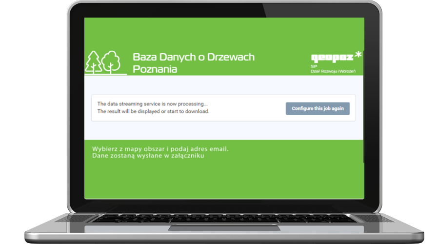
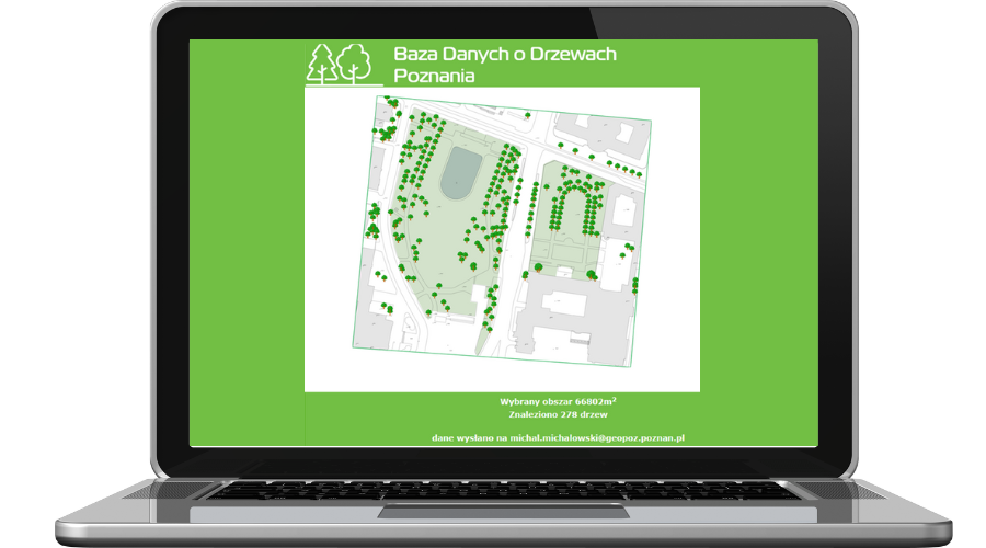
Urban forestry database
FME plays a pivotal role in creating the urban forestry database. It functionalizes:
- Input dataset synchronization -> unifying object registers and data collected when creating an inventory
- Calculations, for example, determining tree heights
- Lists of information from the urban forestry database related to e.g., locations and tree species composition within the road lanes, potential interactions with urban infrastructures, etc.
- Sets for publishing in the forestry portal
Applications for municipal departments
GEOPOZ harnessed FME to create user-friendly web applications serving municipal departments. These applications facilitated report generation, improving operational efficiency for departments like Real Estate and Urban Planning.
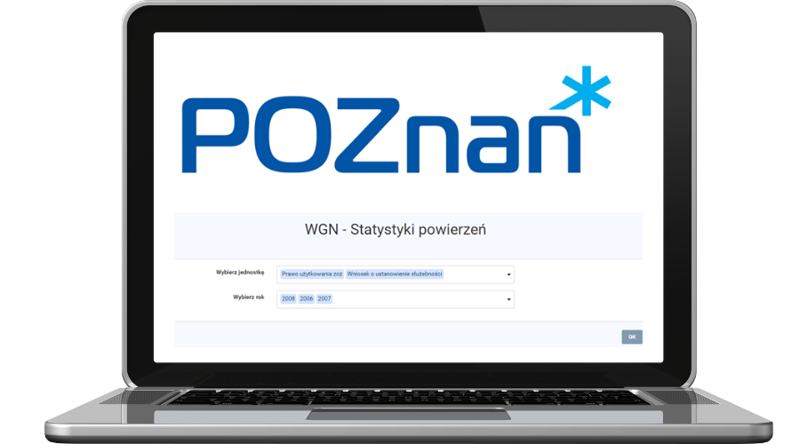
- Application for generating entrustment statistics for the Real Estate Department
This app is used for creating reports about real estate proceedings. Department employees can select two parameters: the proceedings type and year.
The results are saved in the XLS format and include information about the number of proceedings, entrusted areas, etc.
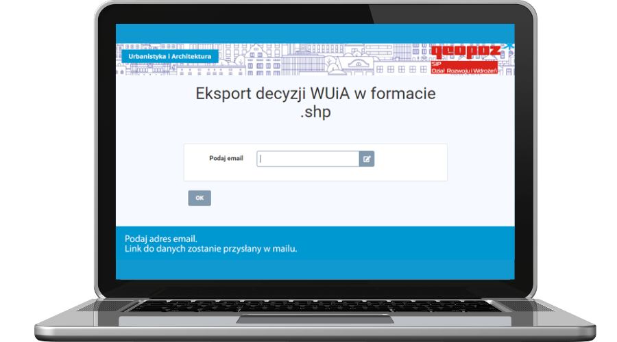
- Application for downloading decisions of the Department of Urban Planning and Architecture
Another application created by GEOPOZ allows users to download decisions made by the Department of Urban Planning and Architecture as an annual statement.
The user gets an SHP file for a chosen year. The script has internally set internal parameters, e.g., historical plot recognition.
GIS database maintenance
Another important FME use case at GEOPOZ is importing data into the city’s GIS database.
During this process, FME:
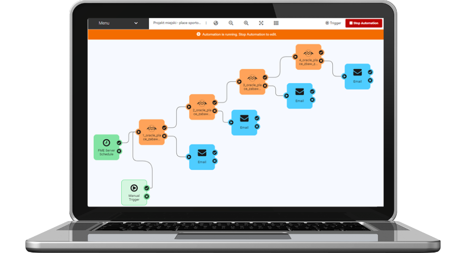
- Synchronizes objects that create a layer of city sports grounds. The algorithm consolidates works performed at the photogrammetric stations and the QGIS workstations. The data editing is performed in two separate GIS systems based on the Oracle database. Data processing includes vector data as well as DTM (Digital Terrain Model). Data are updated every day.
- Synchronizes data about underground utilities with the GIS system. The data are acquired from the Municipal Surveying and Cartographic Documentation Center’s database. In this process, FME selects objects in the Oracle database at the MSCDC, connects data dictionaries, and creates objects adjusted to the publishing standards in the GIS system. The data are updated every day.
- Downloads data from the central databases using the ATOM service. ATOM is used for downloading predefined datasets or their elements, and it doesn’t require the user to set the parameters. GEOPOZ downloads data from the National Register of Boundaries, e.g., forest inspectorate data or information about census areas. Another type of data used by GEOPOZ in this process is related to the topography of Poland and landscape protection areas. Some of the downloaded data are saved as backups in geopackage databases.
Which new FME platform functions were particularly useful at GEOPOZ?
The new functions of FME Flow (formerly FME Server) significantly improved our operations and the quality of final products for our end users. FME Flow automations are revolutionary in the data processing cycle and motivate us to make continuous changes in our organization.
Michał Michałowski, Head of the GIS Development and Implementation Department, GEOPOZ

Introducing automation at GEOPOZ allows employees to create cause-and-effect sequences that are clear for the people who manage the code and update procedures. Automations expand previous task schedules and offer a much more intuitive interface as well as error information.
According to the FME users at GEOPOZ, some other useful functions include:
Creating applications in website form with connected FME algorithms
Embedding interactive maps in interfaces
Combining information from point clouds with other objects
Combining FME with Python through PythonCaller and PythonCreator transformers
Results
With FME, GEOPOZ completed all key projects mentioned above: the 3D map of Poznań, the urban forestry database, and applications for municipal departments. FME also helps GEOPOZ import data powering the city’s GIS system.
As an integration platform, FME allowed us to perform all tasks using a single tool. This shortened the time needed to prepare algorithms and made it more convenient to maintain scripts. Moreover, FME greatly limited the number of additional software needed to complete our tasks.
Michał Michałowski, Head of the GIS Development and Implementation Department, GEOPOZ
What are the results in numbers?
Generating buildings for the 3D browser
about 100 000
buildings
205 GB
of LiDAR data
2,5 GB
of DTM data
With time, GEOPOZ employees learned more about FME’s possibilities. The software producer also introduced improvements to the platform. Therefore, data processing efficiency improved further.
At the FME implementation stage, data processing and generating buildings for the 3D browser took about 3 to 4 hours. Currently, processing entire data sets takes 30 to 40 minutes. Therefore, processing efficiency grew sixfold.
Migrating data for the Real Estate Department
Data are migrated from the GEO-MAP file databases and the local geometry into the Oracle database.
Before implementing FME
The process of managing the local database was ineffective and error-prone. Creating a migration process was complicated and required connecting several application environments.
After implementing FME
The migration process required creating a single algorithm with several initial parameters. Parameterization eliminated user errors, such as typos and inconsistent naming. Currently, migration takes about 30 minutes and is repeated until the source database is fully corrected.
Future plans
The FME platform is a crucial tool at GEOPOZ and its employees find new, interesting use cases that help them improve everyday work and create new products.
GEOPOZ is already envisioning further innovation with FME:
- Custom applications tailored to specific user groups through app FME Flow’s app function,
- Enhanced automation for the GIS system,
- Ongoing improvements to Poznań’s 3D model and related processes.

Would you like to achieve similar results?
If your organization seeks similar achievements, consider FME’s potential. Fill out the form and our consultants will help you uncover FME’s value for your needs.
You can also reach out to us via e-mail or phone:
fme@globema.pl
+ 48 22 848 73 13

Explore similar success!
MPO Łódź
E-services, reports, and local zoning plans
Learn how the Municipal Planning Office (MPO) in Łódź uses the FME Platform to create local zoning and land use plans, spatial analyses, and new solutions.
AI Clearing
Improved analyses and conversion of spatial data related to construction projects
AI Clearing performs analyses of their client spatial data to monitor the construction progress and real-time quality control. Learn how the company uses the FME Platform to complete its analyses 10 times faster than before.